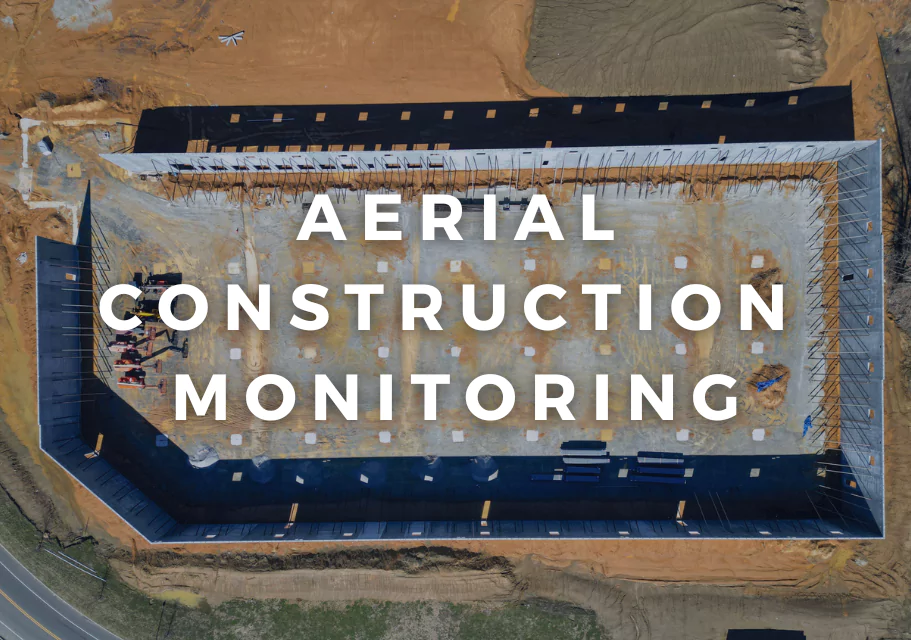
Construction sites are high-pressure environments where staying on track, ensuring safety, and meeting compliance demands are critical. Traditional inspections, often relying on manual measurements and infrequent visits, can miss key details, heighten risks, and lead to costly delays. Drones, operated by FAA-licensed pilots with advanced GIS and mapping expertise, are revolutionizing how projects are tracked, delivering precise data and real-time insights that transform site management.
Challenges of Traditional Construction Monitoring
Managing a construction site comes with hurdles that slow progress and raise costs:
Time-Consuming Inspections: Manual surveys of large or complex sites can take hours, often overlooking subtle issues like early structural wear or misaligned materials.
Safety Concerns: Sending workers onto scaffolding, roofs, or unstable areas increases fall risks, which OSHA reports account for over 30% of construction injuries.
Incomplete Data: Ground-based methods struggle to capture comprehensive, up-to-date information, delaying decisions and risking errors.
Compliance Shortfalls: Audits, legal disputes, or regulatory reviews demand detailed records, which traditional approaches often fail to provide consistently.
These issues create inefficiencies and expose projects to risks. Professional drone services, with skilled pilots and advanced tools, address these challenges directly, enhancing safety and precision.
The Power of Drone-Based Monitoring
Drones equipped with high-end sensors and flown by licensed pilots with GIS expertise deliver unmatched efficiency and accuracy. Research shows drone surveys can reduce inspection times by up to 70% while providing richer data than manual methods. Here’s how they reshape construction monitoring:
High-Resolution Orthoimages: Drones capture time-stamped aerial images, creating orthomosaics with centimeter-level accuracy using Real-Time Kinematic (RTK) systems. These serve as reliable records for progress tracking, compliance audits, or dispute resolution.
3D Mapping and Volume Analysis: Using LiDAR or photogrammetry, drones produce detailed 3D models and calculate material stockpiles with up to 90% accuracy, per industry studies, minimizing rework and optimizing resource use.
Thermal Imaging: Thermal sensors detect heat anomalies, such as insulation gaps, electrical faults, or water leaks, preventing issues before they escalate. A building diagnostics study found drones identified energy inefficiencies missed by manual inspections.
Real-Time Insights: Live feeds or frequent surveys deliver current data, enabling managers to spot delays, hazards, or misalignments quickly and adjust plans proactively.
These capabilities require more than a basic drone. Pilots with GIS training process raw data into actionable deliverables, like annotated maps or volumetric reports, ensuring the information drives effective decision-making.
Navigating Compliance and Ethical Operations
Commercial drone use demands strict adherence to FAA regulations. Part 107 certification is required, covering airspace navigation, weather assessment, and safety protocols. Unlicensed flights risk fines starting at $1,000 per violation, plus liability for damages or injuries. Professional services secure waivers for complex operations, like flights in controlled airspace, and carry specialized insurance to cover accidents or property damage.
Ethical considerations are also key, especially for projects near sensitive ecosystems. Drones can disturb wildlife, particularly birds or mammals, if flown too low or during breeding seasons. Studies recommend maintaining altitudes above 100 meters and using quieter electric models to minimize stress responses. Compared to ground surveys, drones often have a lower environmental footprint, making them valuable for monitoring construction impacts on habitats, like erosion or wetland preservation. Responsible operators prioritize these guidelines, ensuring projects align with environmental stewardship. Look for upcoming posts on our blog exploring drone-wildlife interactions and best practices for eco-conscious operations.
Why Your Drone Falls Short
Many construction firms own consumer drones, like the DJI Mini or Mavic Air, assuming they’re enough for inspections. While these are great for basic photos, they lack the tools and expertise needed for professional work:
Equipment Gaps: Consumer drones often miss RTK accuracy, thermal sensors, or high-resolution zoom, critical for detailed surveys or hazard detection.
Skill Requirements: Effective flights need FAA certification and GIS expertise to produce orthomosaics, 3D models, or audit-ready reports. Untrained staff may capture footage but struggle with actionable insights.
Time and Costs: DIY flights involve training, maintenance, and data processing, which can take hours. Professionals deliver processed results in under 24 hours, saving time and resources.
For example, a manager using a consumer drone might miss a structural crack due to low-resolution imagery, leading to costly repairs. A professional service with GIS skills ensures precise, actionable data that prevents such oversights.
Benefits of Professional UAV Services
Partnering with licensed drone operators offers clear advantages for construction projects:
Enhanced Safety: Drones eliminate risky climbs, reducing injury rates and potentially lowering insurance costs, as falls are a major construction hazard.
Informed Decisions: Real-time data, like 3D models or thermal reports, supports faster, smarter choices, keeping projects on track and within budget.
Robust Documentation: Comprehensive digital records, from orthoimages to volume calculations, ensure readiness for audits or legal reviews.
Environmental Responsibility: GIS-trained pilots monitor ecological impacts, like soil erosion, while following wildlife-friendly guidelines, aligning with sustainable practices.
These benefits require expertise beyond owning a drone, ensuring projects run smoothly and ethically.
Stand Out with Drone-Driven Visibility
Few construction firms promote drone monitoring online. Using keywords like “drone construction surveys” or “aerial project monitoring” can boost your SEO, helping clients find you first. Early adoption showcases innovation, setting your business apart in a competitive market.
Suave Droning: Precision and Responsibility
Ready to elevate your construction monitoring? Professional UAV services with FAA-licensed pilots and GIS expertise deliver the data you need to succeed. At Suave Droning, we provide RTK-equipped drones, thermal imaging, and LiDAR scans across Staten Island, New Jersey, and Pennsylvania. Our processed deliverables, like orthomosaics and 3D models, support project management and compliance while prioritizing environmental responsibility in client projects. We select partnerships that align with ethical standards, ensuring minimal ecological impact.
Contact us for a consultation or test scan to experience the difference. Stay tuned for upcoming posts on drone applications in environmental monitoring and wildlife-friendly practices.
📩 Contact Suave Droning or book an introductory call here.