Clarity from Above.
Aerial inspections, thermal imaging, mapping, and documentation for the people who need to see their sites clearly.
Drone Inspections
Roof, facade & infrastructure
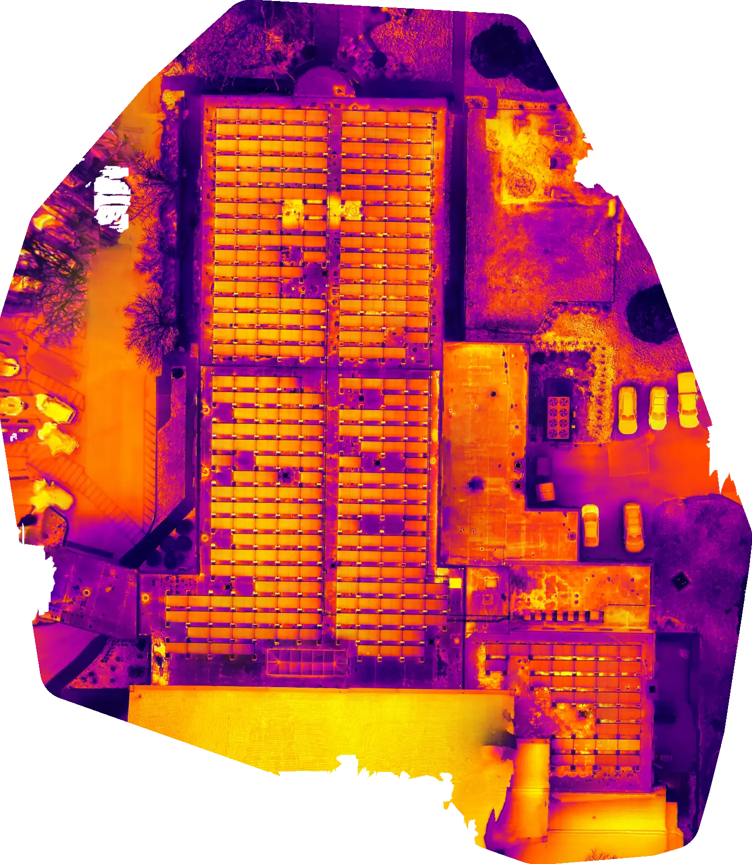
Thermal Imaging
Moisture, heat loss & damage
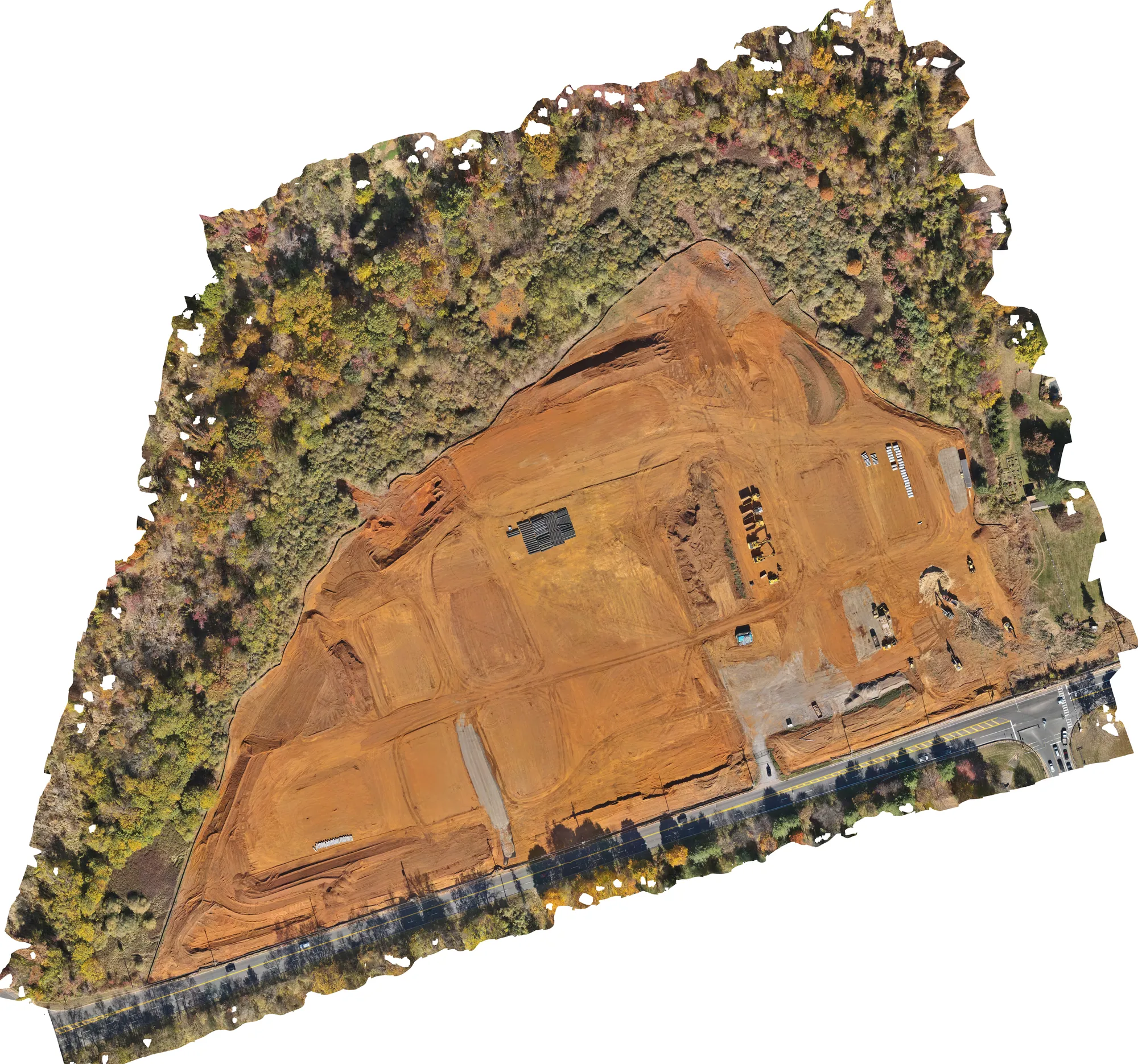
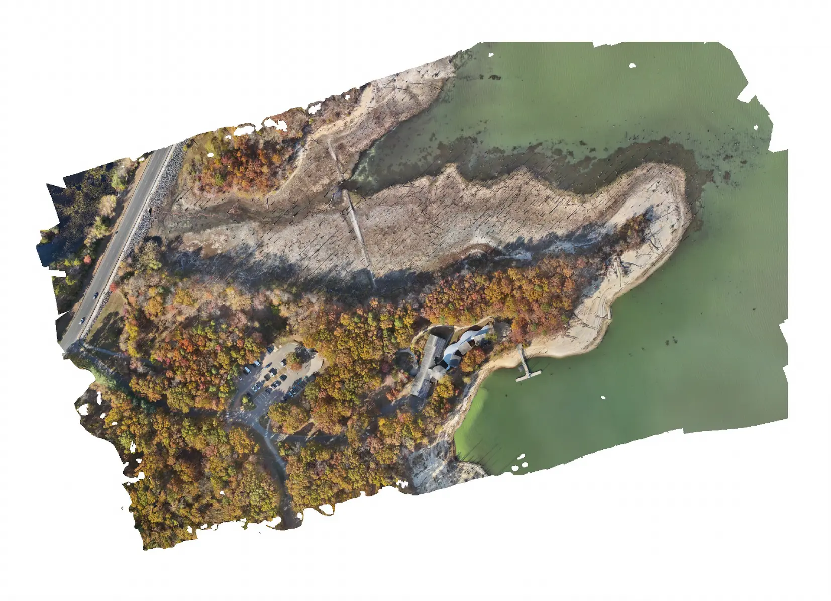
Orthomosaic Maps
Measure & pinpoint from any pixel
Photo & Video
Documentation & marketing
Solutions for Your Sector
Every industry we work with has different problems to solve. Below, we break down what we actually do for each sector and what you get back.
For Public Safety & First Responders
In critical moments, clarity is everything. We capture overhead imagery of incident scenes and stitch it into a single, measurable map. Investigators can mark evidence locations, measure distances between objects, and share exact coordinates with other agencies.
- Produce objective, birds-eye scene maps for After-Action Reviews (AARs).
- Develop training scenarios overlaid on real-world site imagery, not generic diagrams.
- Monitor active scenes from above to identify hazards and coordinate response.
- Pre-plan high-risk locations with detailed aerial maps your team can reference in the field.
An unbiased visual record your whole team can reference, measure, and share.
Explore an Interactive Map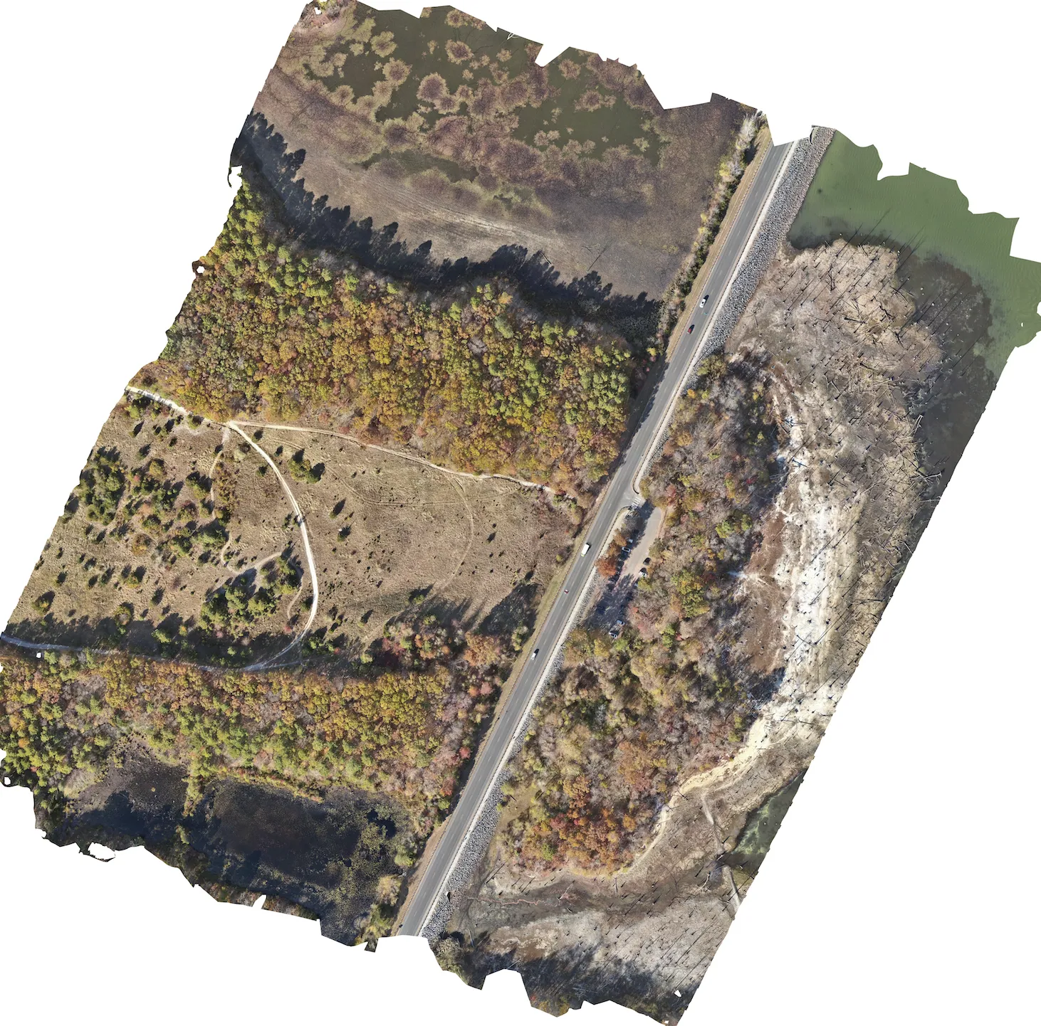
For Property & Facility Managers
Our thermal cameras find problems you can't see with the naked eye: trapped moisture in roofing membranes, energy leaking through facades, and heat signatures from pest activity. We deliver annotated reports showing exactly where the issues are, along with overhead maps you can hand directly to your repair crews.
- Detect hidden moisture infiltration and energy loss with thermal roof scans.
- Generate annotated photo reports with issue locations marked and described.
- Identify pest and wildlife entry points without sending anyone up a ladder.
- Provide overhead property maps where you can measure areas and pinpoint issues for vendors.
Find what's wrong, see exactly where it is, and send your crew to the right spot.
For Construction & Development
We photograph your entire job site from the air and stitch those images into a single, scrollable overhead map called an orthomosaic. Every pixel in the map carries GPS coordinates, which means your team can click any point to get a lat/long, measure square footage for estimates (not survey-grade, but useful for bids), and compare maps week-over-week to track progress. You can even export a pin location and send it to a subcontractor who opens it in Google Maps and drives straight to the problem.
- Get overhead site maps you can zoom into and measure directly.
- Compare progress side-by-side across weeks or months of flights.
- Share pin locations with subcontractors so they know exactly where to go.
- Provide stakeholders and investors with clear visual documentation of site conditions.
One map your whole team can read, from the office to the field.
For Insurance & Legal Professionals
We provide thorough, objective aerial documentation for claims, underwriting, and legal proceedings. Our images are geotagged and timestamped, and when needed, we build full orthomosaic maps so adjusters and attorneys can measure affected areas, compare before and after conditions, and present visual evidence that speaks for itself.
- Capture timestamped, geotagged aerial imagery for accident or damage scenes.
- Produce comprehensive photo records for insurance claims and property underwriting.
- Build measurable site maps that can support evidentiary exhibits and depositions.
- Reduce time-to-resolution with rapid, thorough, and safe documentation.
Objective visual evidence with the metadata to back it up.

For Environmental & Compliance
We help environmental teams document site conditions, monitor changes over time, and produce the visual records regulators expect. Our aerial maps cover large areas quickly and include measurement tools so you can quantify what you're seeing without extra survey visits.
- Conduct site assessments over large or hard-to-access areas in a single flight.
- Map drainage patterns, floodplains, and stormwater infrastructure from above.
- Track vegetation health, wildlife corridors, and habitat changes over seasons.
- Deliver organized documentation formatted for regulatory and compliance submissions.
Thorough aerial records that satisfy regulators and save your team field time.
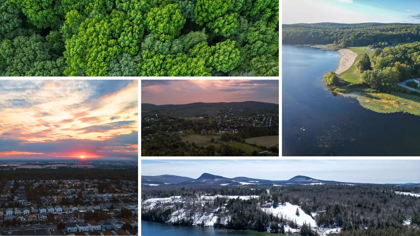
For Marketing & Media
From sweeping landscapes to dynamic close-ups, our aerial visuals captivate clients and stakeholders. Elevate your brand with cinematic, high-impact imagery.
- Showcase commercial real estate or event venues with breathtaking angles.
- Elevate marketing campaigns with cinematic 4K video footage.
- Highlight construction progress or completed projects for investors.
- Engage your audience with visuals that tell a powerful story.
Stunning aerial imagery that sells your story, fast.
Ready to See the Difference?
Let's talk about your project. We'll walk you through exactly what you'd get back and how your team would use it.
Request a Quote