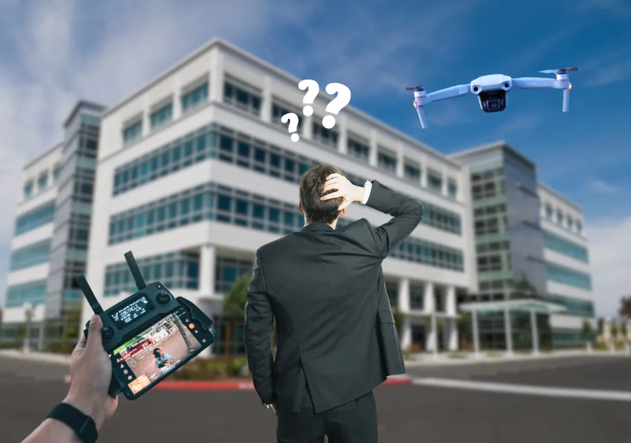
Owning a drone might seem like a shortcut to cutting costs for property inspections, environmental monitoring, or facility management. It’s tempting to think a DJI Mini or Mavic Air can handle it all. But here’s the reality: a drone is just a tool. Its value lies in how it’s flown, how the data is processed, and whether it delivers insights that drive decisions. Without expertise in advanced GIS, mapping, and FAA compliance, your drone might be missing critical details or even putting you at risk.
This article dives into why professional UAV services, with licensed pilots skilled in geospatial analysis, elevate drone use beyond basic snapshots. It’s tailored for property managers, contractors, and environmental professionals, offering practical knowledge on drone capabilities, legal considerations, and environmental impacts.
The Limits of Consumer-Grade Drones
Many businesses invest in consumer drones like the DJI Mini or Mavic 3, expecting them to handle professional tasks. These are great for casual photos or videos, but they often fall short for complex inspections or environmental work. Advanced applications require specialized equipment and expertise:
Precision Mapping: Consumer drones lack Real-Time Kinematic (RTK) systems, which provide centimeter-level accuracy for mapping. This is critical for tasks like property boundary assessments or topographic surveys, where precision drives decisions.
Thermal Imaging: Professional drones with thermal sensors detect heat anomalies, such as moisture leaks, electrical faults, or wildlife activity. Studies show thermal imaging can identify issues like pest nests in walls or attics, invisible to standard cameras.
High-Resolution Zoom: Optical zoom (up to 56x on enterprise models) allows detailed inspection of structures or terrain without flying too close, reducing risks in sensitive areas.
Without these capabilities, businesses miss key data. For example, a property manager using a consumer drone might capture roof photos but fail to spot a heat signature indicating a hidden leak, leading to costly repairs later. Professional services bridge this gap with advanced tools and analysis.
Navigating FAA Compliance and Legal Risks
Flying a drone for business isn’t the same as recreational use. FAA Part 107 certification is required for commercial operations, covering airspace rules, weather assessment, and safety protocols. Unlicensed flights can lead to fines starting at $1,000 per violation, with potential liability for damages or injuries.
Key compliance considerations include:
Airspace Regulations: Pilots must navigate controlled airspaces, using tools like LAANC for approvals or checking NOTAMs for restrictions. Untrained operators risk violations near airports or sensitive sites.
Insurance Needs: Commercial drone operations require specialized insurance to cover accidents, property damage, or injuries. Without it, businesses face significant financial exposure.
Incident Reporting: Accidents, like a drone crashing into equipment, must be reported to the FAA or local authorities. Non-compliance can escalate penalties.
For environmental professionals, additional permits may be needed for wildlife monitoring to avoid disturbing protected species. Research indicates drones flown responsibly cause less stress to animals than ground surveys, but only when operators follow guidelines like maintaining 100-meter distances. An untrained employee flying a company drone could unknowingly break these rules, risking fines or project delays.
Turning Raw Data into Actionable Insights
A drone’s footage is only as good as the insights it provides. Consumer drones capture images, but without geospatial expertise, those images often sit unused or fail to meet professional needs. Advanced GIS and mapping skills transform raw data into deliverables like:
Orthomosaics: Stitched aerial images with precise measurements for construction, land planning, or environmental assessments. Studies show orthomosaics improve accuracy in site surveys by up to 90% compared to manual methods.
3D Models: Detailed terrain or structural models for visualizing changes, used in applications like flood risk analysis or facility management.
Thermal Analyses: Reports highlighting heat anomalies, critical for spotting pest activity, water intrusion, or energy inefficiencies.
For example, an insurance adjuster needs claim-ready reports with annotated damage assessments. A contractor’s DIY drone photos might lack the resolution or context to secure a claim, while professional services deliver structured, actionable data. In environmental work, GIS expertise enables habitat mapping or wildlife tracking, supporting conservation efforts without invasive methods.
Efficiency: Time Is Money
DIY drone flights sound efficient, but they’re often slower than expected. Training staff, planning flights, and processing data take time—hours that professionals streamline. Consider:
Flight Planning: Licensed pilots with GIS training optimize flight paths for coverage and accuracy, completing inspections in 20-30 minutes versus hours for untrained operators.
Data Processing: Turning raw footage into orthomosaics or 3D models requires specialized software and skills. Professionals deliver reports in under 24 hours, while DIY efforts can drag on.
Environmental Sensitivity: In wildlife monitoring, professionals adjust flight altitudes and timing to minimize disturbance, as studies recommend avoiding low flights during breeding seasons.
A contractor spending three hours flying and analyzing data could’ve hired a service to deliver better results faster. This efficiency translates to more jobs completed and higher client satisfaction.
The Hidden Costs of DIY Drones
Owning a drone involves more than the purchase price. Upfront costs for enterprise-grade models, ongoing maintenance, FAA certification training, and software subscriptions add up. Then there’s the time spent learning to fly legally and process data effectively. Professional services eliminate these burdens, offering:
Access to advanced equipment like RTK-enabled drones or thermal sensors.
Expertise in GIS and mapping for precise, usable deliverables.
Full compliance with FAA and local regulations, reducing legal risks.
For environmental professionals, studies highlight that professional drone services reduce wildlife disturbance compared to amateur flights, which may lack awareness of ecological guidelines. The cost of a service is often offset by avoiding fines, repairs, or missed opportunities.
Why Professional UAV Services Add Value
Partnering with a licensed drone service with GIS expertise ensures you get more than footage. You get insights that drive decisions, from spotting pest entry points to mapping flood-prone areas. These services also understand environmental considerations, using data from wildlife studies to minimize impacts. For businesses, this means safer operations, lower costs, and a reputation for innovation.
Stand Out with Drone-Driven SEO
Few companies in wildlife exclusion, pest control, or environmental management promote drone services online. By using terms like “drone-assisted pest detection” or “aerial wildlife monitoring,” you can rank higher in searches, attracting clients seeking modern solutions. Early adoption positions your business as a leader in a tech-driven market.
Suave Droning: Expertise You Can Trust
Ready to elevate your operations? Professional UAV services with advanced GIS and mapping skills unlock the full potential of drones. At Suave Droning, we bring FAA Part 107-licensed pilots, RTK-equipped drones, and thermal imaging to deliver precise, actionable data for property inspections, environmental monitoring, and more across Pennsylvania, New York, and New Jersey. Our in-house processing ensures reports meet industry standards, from insurance claims to conservation plans, all while adhering to wildlife-friendly guidelines.
Contact us for a consultation to see how our services can transform your workflow. Stay tuned for upcoming posts on drone applications in wildlife management and minimizing environmental impacts.
📩 Contact Suave Droning or book an introductory call here.